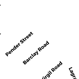
911 Virgil RD
Owner Information
SHANNON ANDREW D
11 VIRGIL RD
WEST ROXBURY, MA 02132


Property Details
911 Virgil RD is classified as a Two-Family Residential (Conventional).
The primary structure on this property was built in 1920. There is 3,346ft2 of residential/living space within this property. This property is listed as having 11 rooms.
911 Virgil RD is valued at $858,600. The land is valued at $234,400 and the structures are valued at $624,200.
The most recent deed for 911 Virgil RD is recorded at the local registrar in Book 55635, Page 095. 911 Virgil RD was last sold on Monday, January 25, 2016 for $550,000.
Assessment data from fiscal year 2020.
Flood Data
According to the FEMA National Flood Hazard Layer, this property does not appear to be in a flood zone. It may also be in an area not yet reviewed. Nonetheless, confirm this information prior to taking any action.
To view the flood hazards around this property, create a FEMA "Firmette" Map of the area around 911 Virgil RD.
Broadband Internet Providers
| Provider | Type | Bandwidth (mbps) | |
|---|---|---|---|
| HughesNet | Satellite | 25 | 3 |
| Verizon New England Inc. | Fiber | 940 | 880 |
| RCN | Cable | 500 | 20 |
| RCN | Cable | 1000 | 20 |
| Verizon New England Inc. | DSL | 10 | 1 |
| GCI Communication Corp. | Satellite | 0 | 0 |
| Viasat Inc | Satellite | 100 | 3 |
| VSAT Systems, LLC. | Satellite | 2 | 1 |
| Comcast | Cable | 1000 | 35 |
Broadband service provider data from December 2020.
Adjacent Properties
- 10 BARCLAY RD
Single Family Residential owned by ROONEY GREGORY T - 14 BARCLAY RD
Single Family Residential owned by LAWLER RICHARD M - 1517 Virgil RD 17-2
Residential Condominium owned by COLLINS TAYLOR - 1517 VIRGIL RD 17-1
Residential Condominium owned by HANNIGAN MARTIN J - 1517 Virgil RD 15
Residential Condominium owned by SWEENEY JULIANNE H - 1517 VIRGIL RD
Other, Open Space owned by FIFTEEN-17 VIRGIL RD CONDO - 57 VIRGIL RD
Two-Family Residential owned by STRICKLAND HAROLD F